PCT CA Section B - Warner Springs to Interstate 10 - 100 Miles
California Section B write up for my PCT experience.

This post is part of a series I am writing to highlight different sections of the PCT and is designed to be a companion to my similar YouTube series. Links to those will appear here as I continue with the project. You can explore the section through the interactive GPS route I've loaded up on Gaia.
Cinematic Replay

🧠 🔨 Introduction - Brain Breaking Thoughts
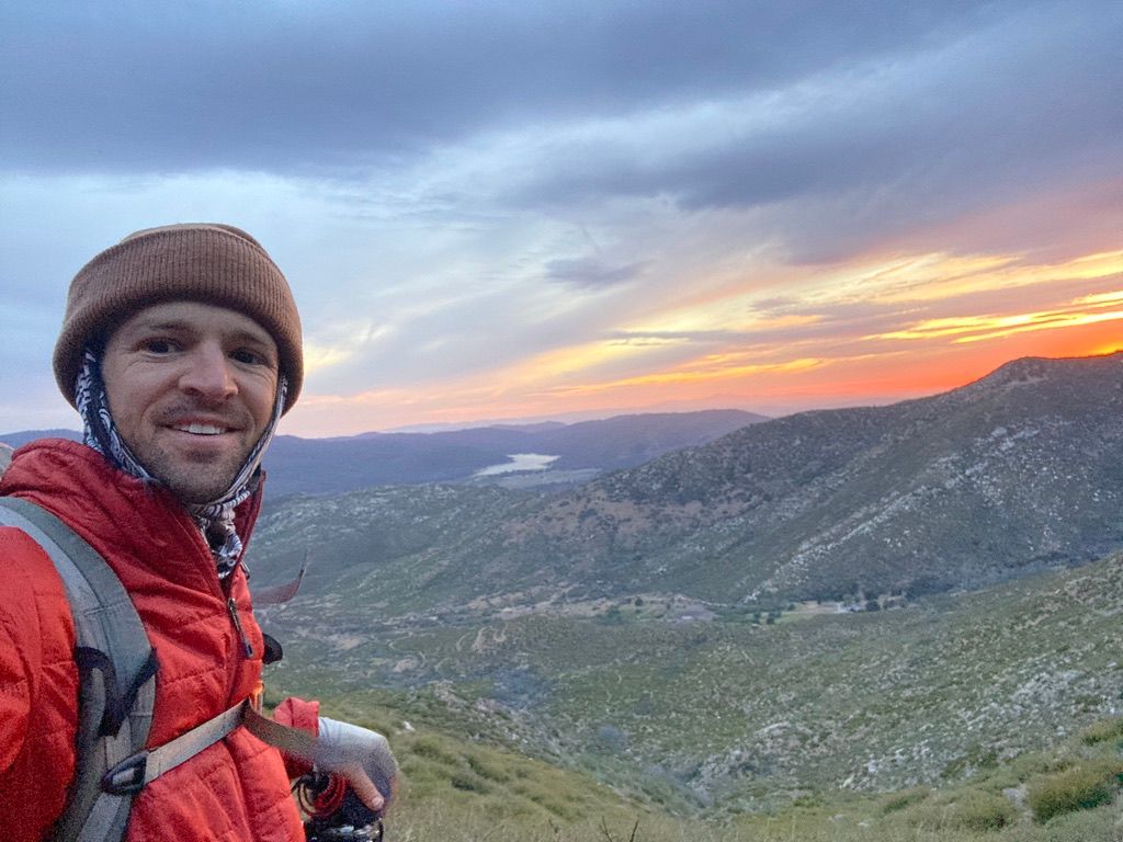
I'm sitting in the hiker oasis under Interstate 10. The road just ten feet overhead shakes with traffic from all the SUVs and semi trucks transiting between Los Angeles and pretty much any American civilization to the east. I'm stuck to the chair. I can't bring myself to get up and carry on. It's not the foot pain. It's not a need for supplies. It's not the mental fatigue of ten days on trail.
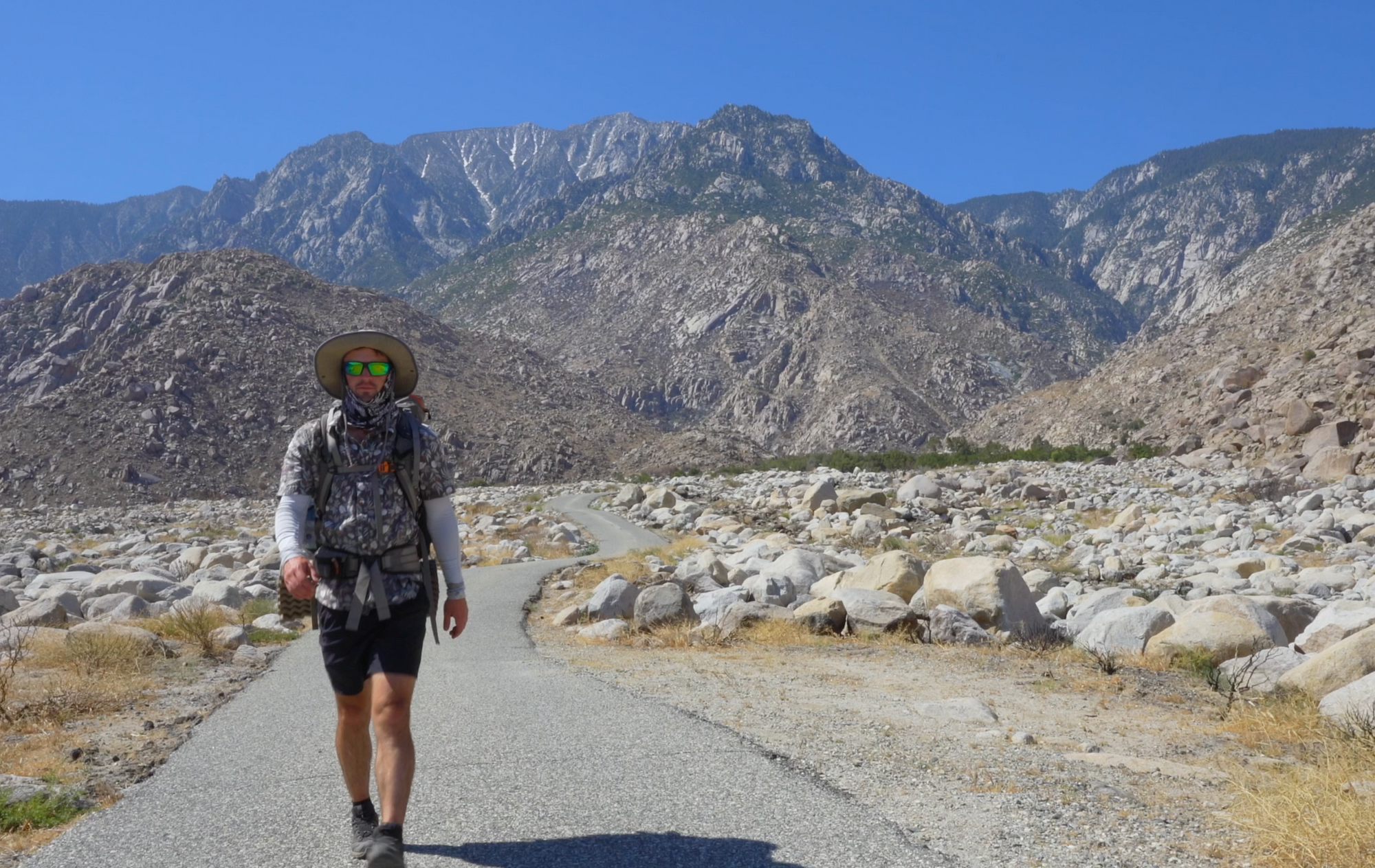
I can't move because San Jacinto just looks so damn big, and it's just such a thought to think that I marched down it all. Ahead, the San Bernardino Mountains loom large as well. The vantage point from Cabazon Valley, dissected by Interstate 10 which is the PCT's low point at 1,195 feet, offers the perfect place for my sense to be overwhelmed. Overwhelmed by what has just been done, and by what is about to occur. How can I hold this feeling inside me forever?
There are experiences along the Pacific Crest Trail that intensify brain activity while simultaneously locking out the motor neurons - Orgasmic Nature Episodes. Neurons extend outward to untapped cerebral territory like the branches of a Ponderosa Pine reaching for unspoiled sunlight. Synapses shoot off like a meteor shower. My brain's spider-web neural network is shimmering with thought.
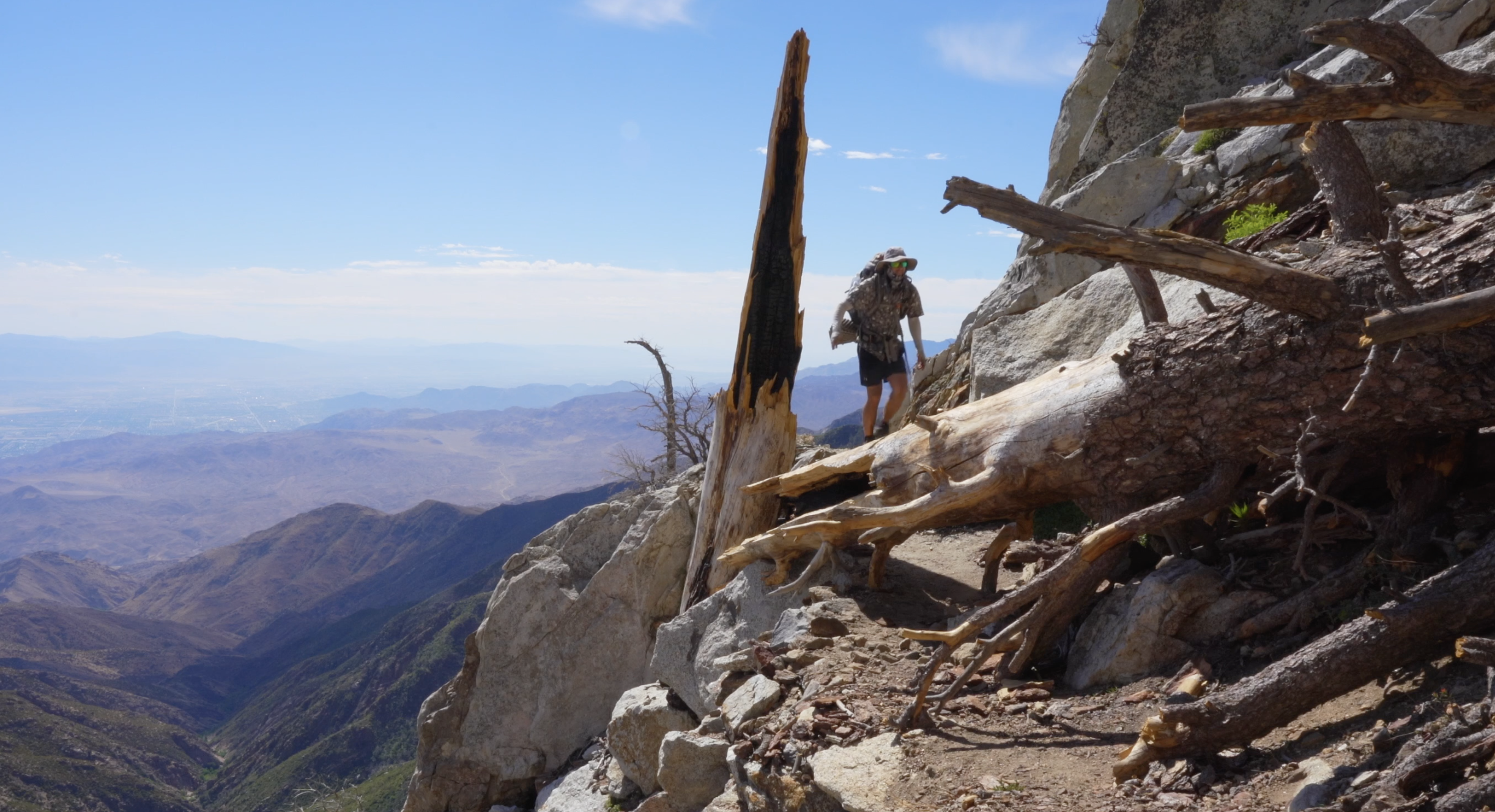
The PCT's descent from San Jacinto down to Interstate 10 is a sustained 28 miles from 9,030 to 1,195 feet. The following (northbound) ascent into the San Bernardino Mountains requires 7,500 feet of climbing along 42 miles of trail. The vantage points which come from the drastic and ever-so-visible changes in elevation combined with the realization that you walked down and up each inch serve to overwhelm any hiker with strong feelings of accomplishment and grandeur. Thank goodness I’m the only one here. I can’t bear the feeling of someone else witnessing my emotional undoing beneath a freeway causeway due to the mere presence of trees and rocks.
🛫 Departure
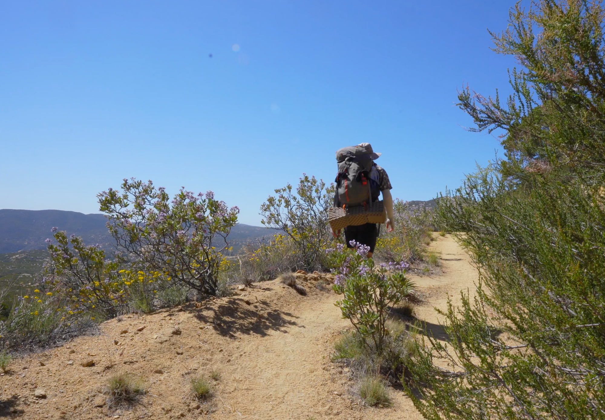
Leaving Warner Springs, the trail meanders up Agua Caliente Creek for a number of miles. The willow, elder, and oak trees through here provide welcome shade, and the creek may or may not provide water depending on the time of year. However, it doesn't take long for the trail to climb out of that little haven and into the familiar land of chaparral dominated by more menacing flora like creosote bush, cacti, and manzanita.

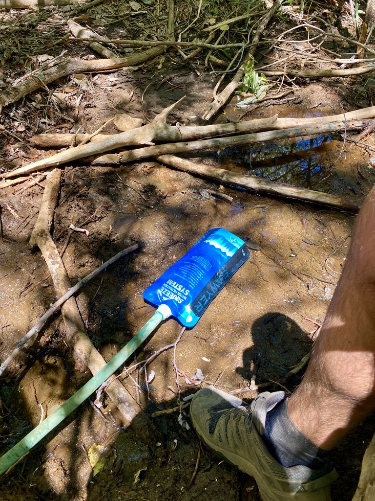
💦 The Search for Water Continues
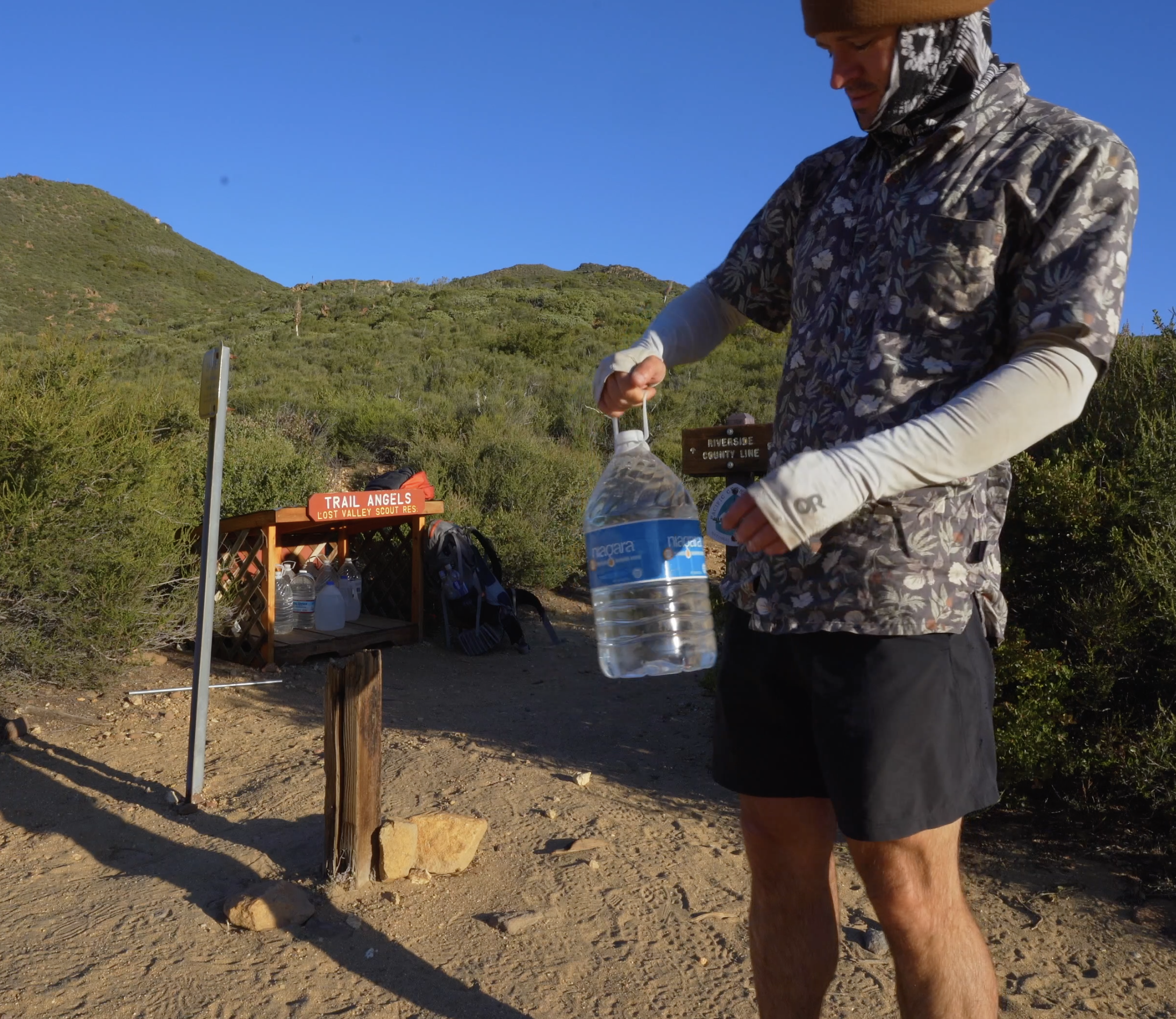
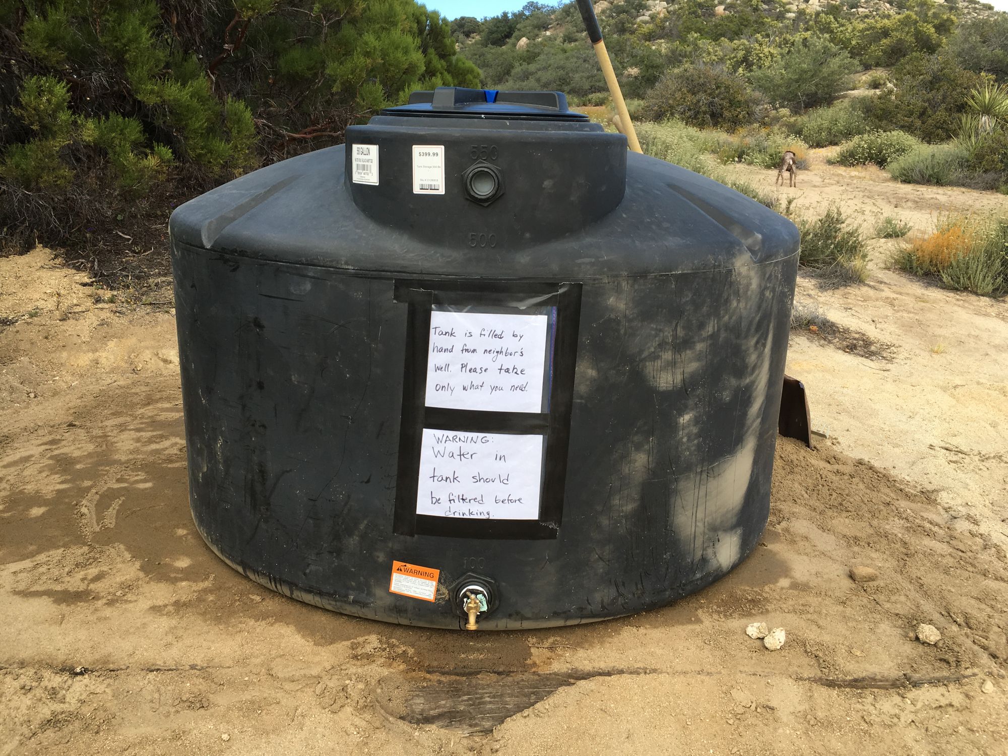
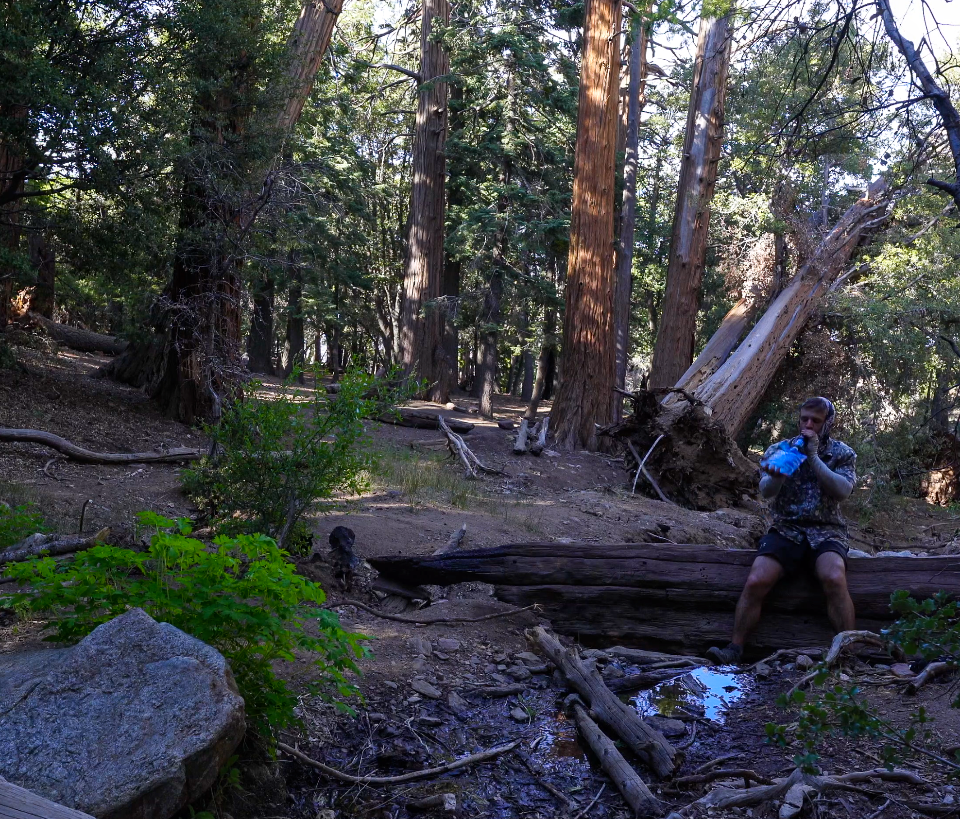
Water is scarce as it was before in Section A. After climbing out of Agua Caliente Creek (Mile 116) and passing a chance for water at Lost Valley Spring (Mile 119), the next natural source can be found at Tule Spring (Mile 137). Preventing an 18+ mile water carry are water tanks at Mike’s Place (Mile 127) and a small water cache maintained by the Lost Valley Boy Scouts at Chihuahua Road (Mile 127) if you opt to skip Mike’s Place. Mary’s Hiker Oasis (Mile 145.4) has a 500 gallon water tank, picnic tables, and even a Little Free Library. I missed her by ten minutes, but Mary often rides her horse up to the oasis to check in and socialize with us.

🎉 Mike’s Place and FOMO (Mile 127)
Everybody’s hike is different. Mike’s Place was where I learned just how different our hikes can be. I was debating stopping by, lured by the possibility of a hot breakfast, but put off by comments in the Guthook Guide App stating things like:
“We are not sure if he [Mike] is away permanently or temporarily but the groundskeeper has very different vibes than the great things we heard about Mikes :cringe: we didn’t stay long.”
“Well that was a strange experience…”
“I visited earlier in the season and commented on the bad vibes… I got the 411 up the trail that the man name Slim there was overstaying his welcome and is actually a freeloading annual PCTer who takes advantage of various trail angel spots along the trail and is way too interested in the looks of female hikers. He is incredibly obnoxious and makes crazy claims.”
“Water was great from the tank, but farther on down the path were bad vibes at Mike’s this year. People overseeing the property while Mike is away are loud, opinionated, and crazy. Like a bad party house where the hosts want to dominate with dumb takes, jokes, and comments on everything.”
“Left immediately after all the weird vibes.”
“Mike wasn’t there, place being run by two drunks trolling for young hikers, girls to clean and cook, boys to work on property. Vulgar, crass, misogynistic, racist, and the beer and sodas floating in the water were warm … Mike’s is horrible”
Not wanting to take a chance at forced labor digging ditches in the hot sun, warm beers, or bad vibes, I opted to skip. My decision was validated as I walked just past the junction to wake a solo female hiker camped out right on the trail. She recounted her story from last night, confirming that whoever was taking care of Mike’s place was a very obnoxious drunk. It was bad enough that she picked up camp and made for the safety of the trail. After confirming she was unharmed, I conducted a vibe check. My vibes were safe.
To be fair, for all of the bad comments there were plenty of good comments heralding Mike’s Place as one of the best stops on the PCT.
“PEEP! Once in a lifetime experience here, nothing but good vibrations and amazing stories to tell.”
“Was warned over and over again to not go here as a solo female hiker. I experienced none of what the bad rumors said…”
“Loved my stop here! Spirit was so welcoming and met an awesome group of hikers here. Heard the bad experiences earlier were due to a hiker who has since lefeet…”
“Mike and Spirit were awesome! This female hiker felt respected by all the hikers.”
It seems that timing is the issue with Mike’s Place. If the right trail angels aren’t around, it is vulnerable to folks coming in and abusing its privileges. So just keep an eye on the recent comments and make your decision that way.
Or skip it. One reason I'm spending so much effort writing about Mike's Place despite not even going is that it is really east to get FOMO (Fear of Missing Out) while on trail. Guthook Guides is a wonderful resource for navigating the PCT, but it is filled with comments like "you need to be here at sunrise" and "best burger/milkshake/person/town/burrito/pie/time on the PCT." After a few weeks out there, I've come to discover that your moments are your own, and they will come and find you. That is the allure of the PCT. Just walk the trail and magic will occur. There are so many opportunities to catch the-picture-doesn't-do-it-justice sights, meet folks you wont ever forget, and eat like a refugee. Don’t get too hung up on trying to relive everybody else's best ever experiences. I exerted way too much mental effort trying to decide on visiting Mike's Place or not. It wasn't until I passed the junction when I realized I could enjoy my walk just fine without it.

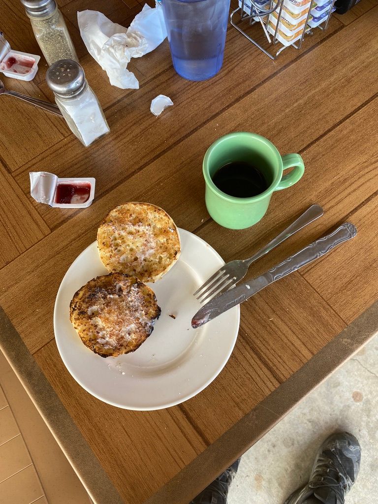
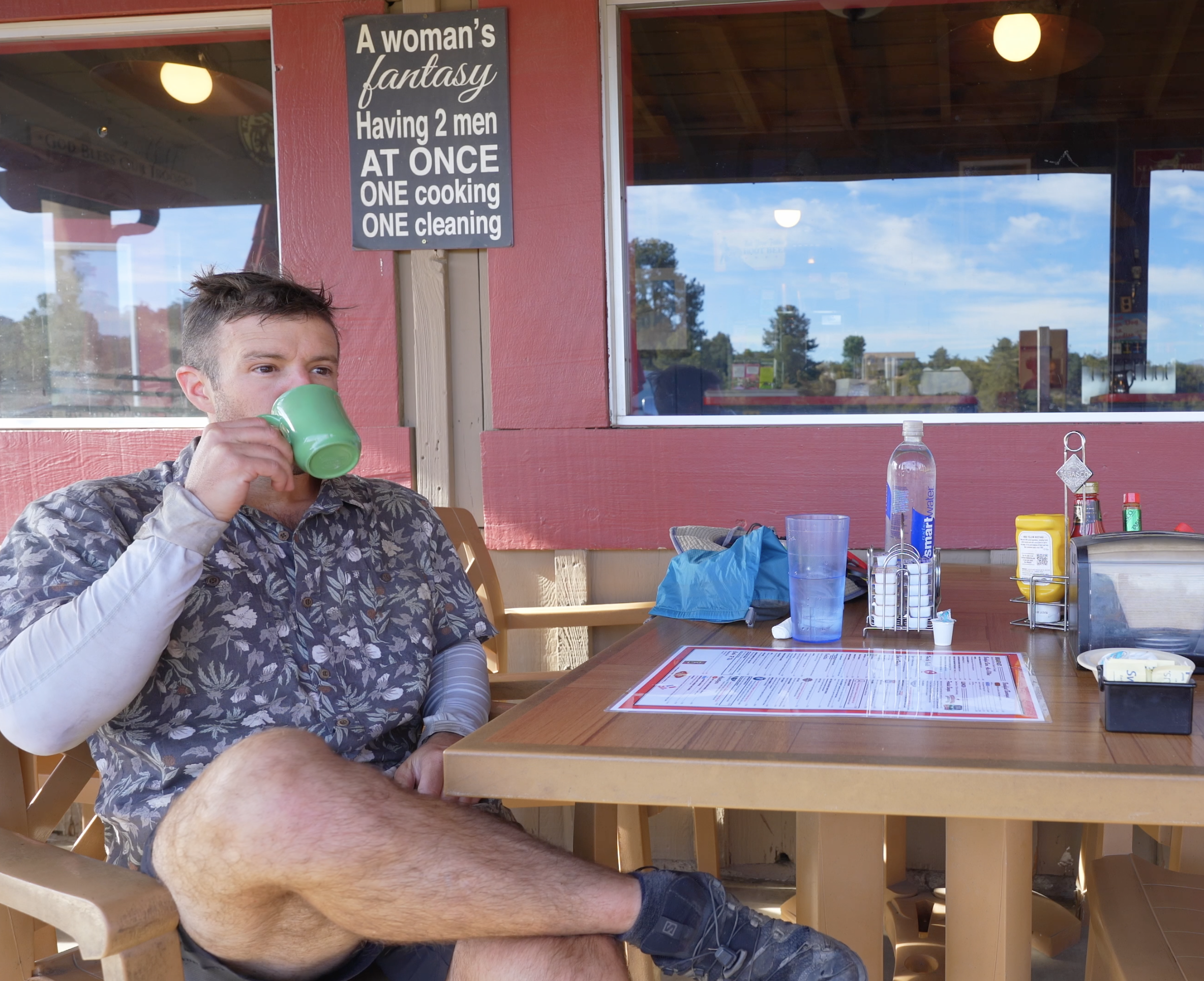
🍔 Paradise Valley Cafe and Anza (Mile 151.8)
It’s only another day or two of hiking for your next chance at a hot meal. North of Tule Springs, the trail skirts around rural civilization in Terwilliger Valley outside the town of Anza. Stumbling onto highway 74, I had the option to head one mile west to Paradise Valley Cafe. I decided to take an easy morning there seeking a brief respite from the trail. Plus, I needed some electricity for my battery pack and a water fill.
Possible feeling some FOMO from skipping Mike's, I put Paradise Valley Cafe on my itinerary. “Best burger on the PCT,” read one of the recent comments in Guthook. I thought that it was all the information I needed. I should have looked at what people had to say about breakfast though since they weren’t grilling burgers that early in the morning, and the breakfast burrito looked A LOT better than my traditional two egg breakfast.
I wasn’t stoked on the food, but the coffee and friendly service was enough to make it a worthwhile break. I was there before the cook had arrived, but the waitress took very good care of me. Since the cafe sits on a busy intersection and caters to “bikers, hikers, and horseback riders” I could totally see this as a better afternoon attraction for a burger, beers, and chatter with characters of the road. I had forgotten my sunglasses at the last campsite, and I lucked out to find another pair stashed away among the junk in the hiker box by the front door. Yup - A total score.
Hikers have the option to hitch a few miles west on highway 371 into the town of Anza if they need a full resupply. The junction to the next stop in Idyllwild is 27 miles up the trail.

🏔 San Jacinto
The climb into the San Jacinto Mountains handed me my first real feelings of isolation on the trail. Whereas Section A has plenty of climbing and a mountain vista overlooking the Anza-Borrego Desert, the trail never seems to stray far from a major road or fails to be criss-crossed by a fire road. Civilization feels just around the corner. San Jacinto differs in that its ruggedness makes it only accessible via footpath. As a result, I didn’t see another soul on trail until bumping into some day hikers at saddle junction into Idyllwild. You won’t find water caches here either.
There is water, though it doesn’t flow conveniently over the trail. The three reliable options: Live Oak Spring, Cedar Spring, and Apache Spring require you to hike a mile or so off trail and to lose a bit of elevation in the process. At mile 162.7, I opted to doff my pack and head down the side trail to Cedar Springs for my water refill. The spring location offers nice camp sites along Garnet Ridge with views down in to Palm Springs, but I still had daylight and wanted to push a bit further.
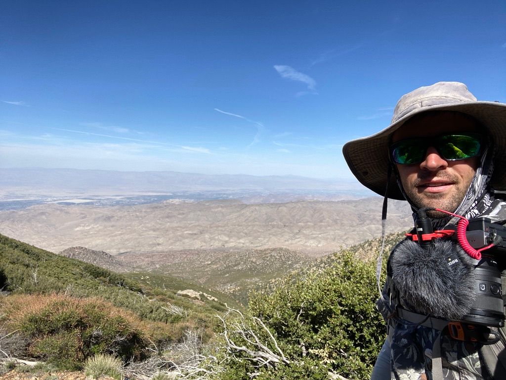
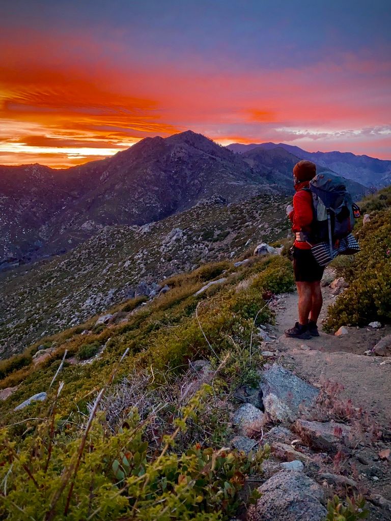
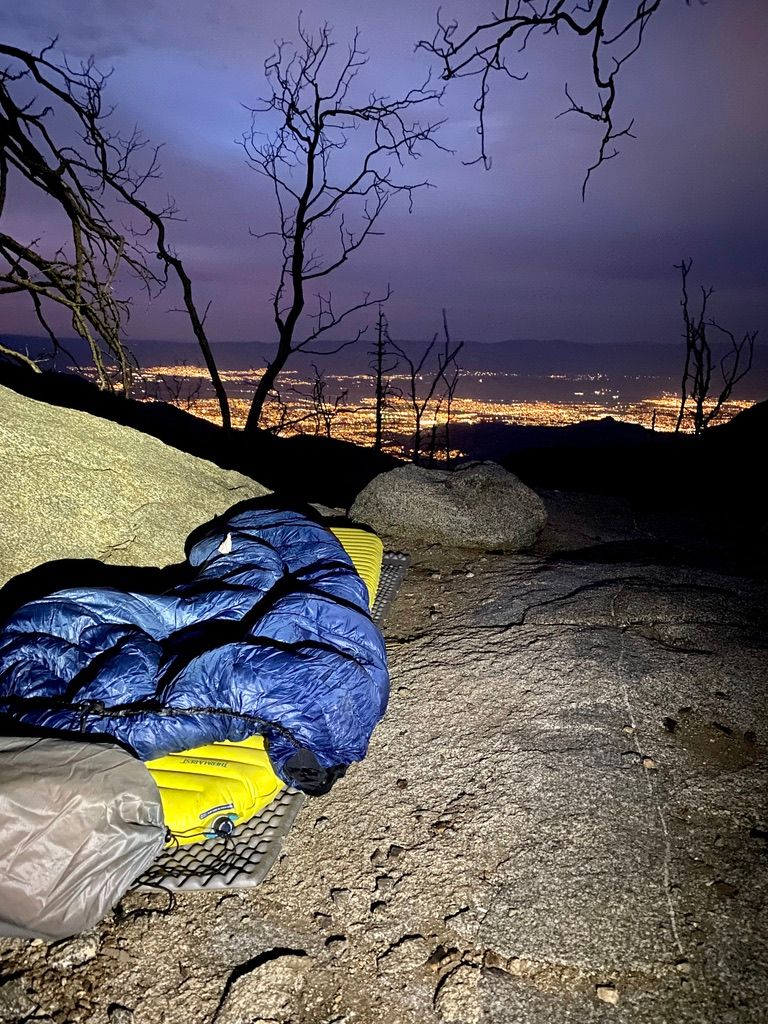
The initial climb takes you from ~5000 feet at Paradise Valley Cafe to ~7000 feet over the mountain crest with a view to Lake Hemet in the west and Palm Springs to the east. I made camp just below the crest on a rock overlooking the sparkling desert city. Just before making camp I was treated to my best sunset yet, which inspired the thumbnail for this section's YouTube thumbnail!
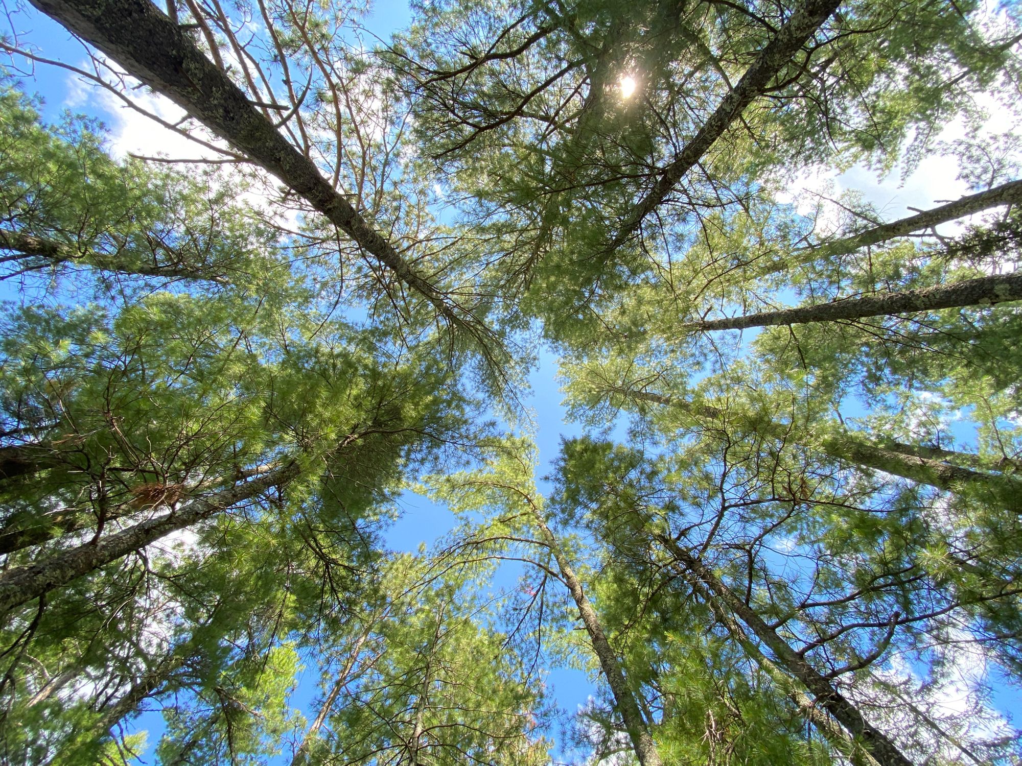
The trail quickly drops back to 6000 feet before heading back up even higher to 8100 feet at Saddle Junction and 9000 feet at the high point. This descent serves to make your overall elevation gain through these mountains just around 4000 feet and prevents you from reaching the cooler ecological zones at higher elevation for a few extra miles. It’s not until you reach 8000 feet or so that the incense cedar, black oak, Jeffrey pine, and white fir forests really lend you their shade. Additionally, Taquitz Creek offers a water source here that doesn’t require a detour off trail.
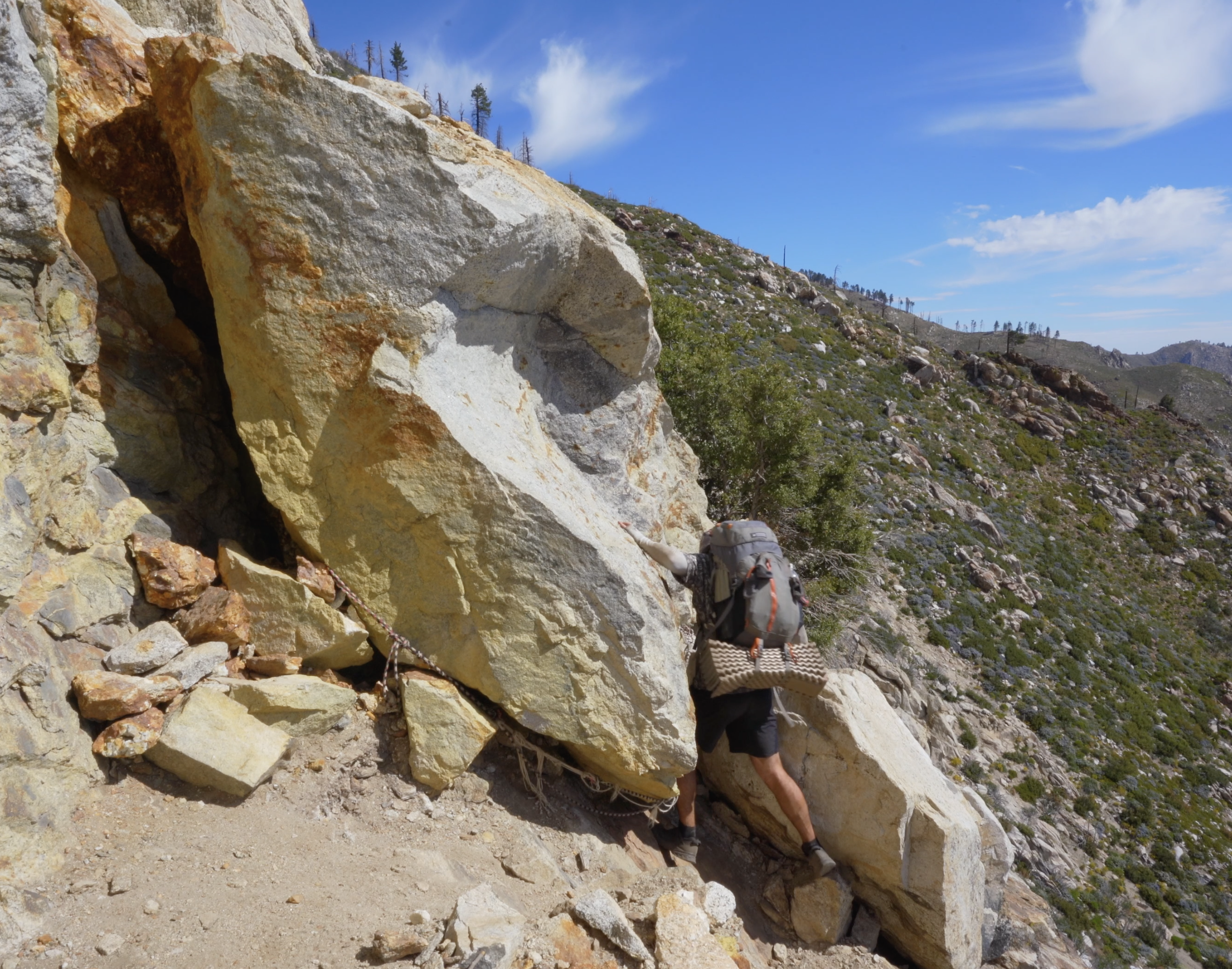
At the time I was hiking, some of the trail was blocked due to a major rockslide but I didn't have much trouble scooting down and around. Having seen a major wildfire about three years ago, there are also many downed trees to hop over and poisonous Poodle Dog Bush to avoid. Look out! As of writing this in July 2021, the rockslide has reportedly been cleared.

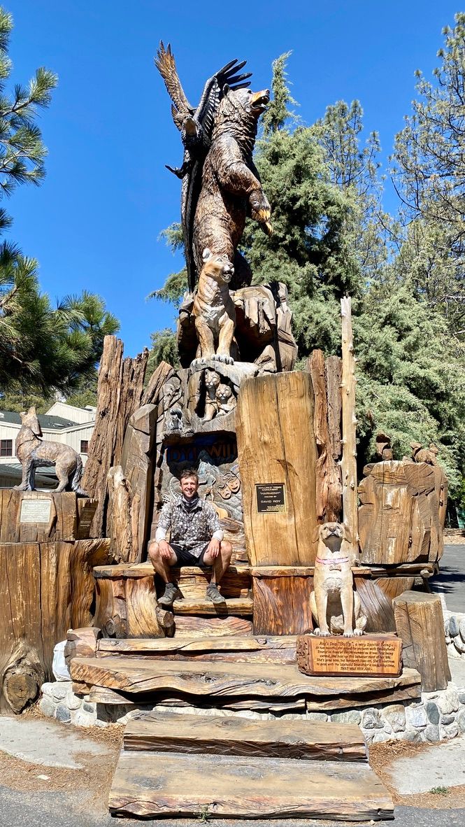
🏘 Idyllwild
Up at elevation, hikers have a number of options whether they like to bag peaks, hit the town, or grind trail miles. San Jacinto Peak is a 10,834 foot peak just a few miles off trail. If you aren’t a purist, you can even link back up with the PCT further north. Most folks describe this detour from the trail as a must, especially if you can time it for sunrise or sunset.
Just before the junction to the summit gives the option to hike 2.5 miles down Devil’s Slide Trail where you can grab a hitch into the town of Idyllwild. A friendly day hiker at the saddle offered me a ride to the inn, which I graciously accepted as I needed to resupply and take a little time off my feet.
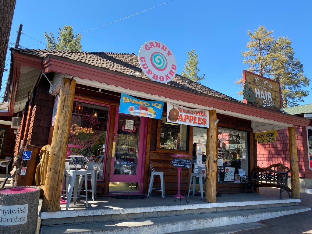
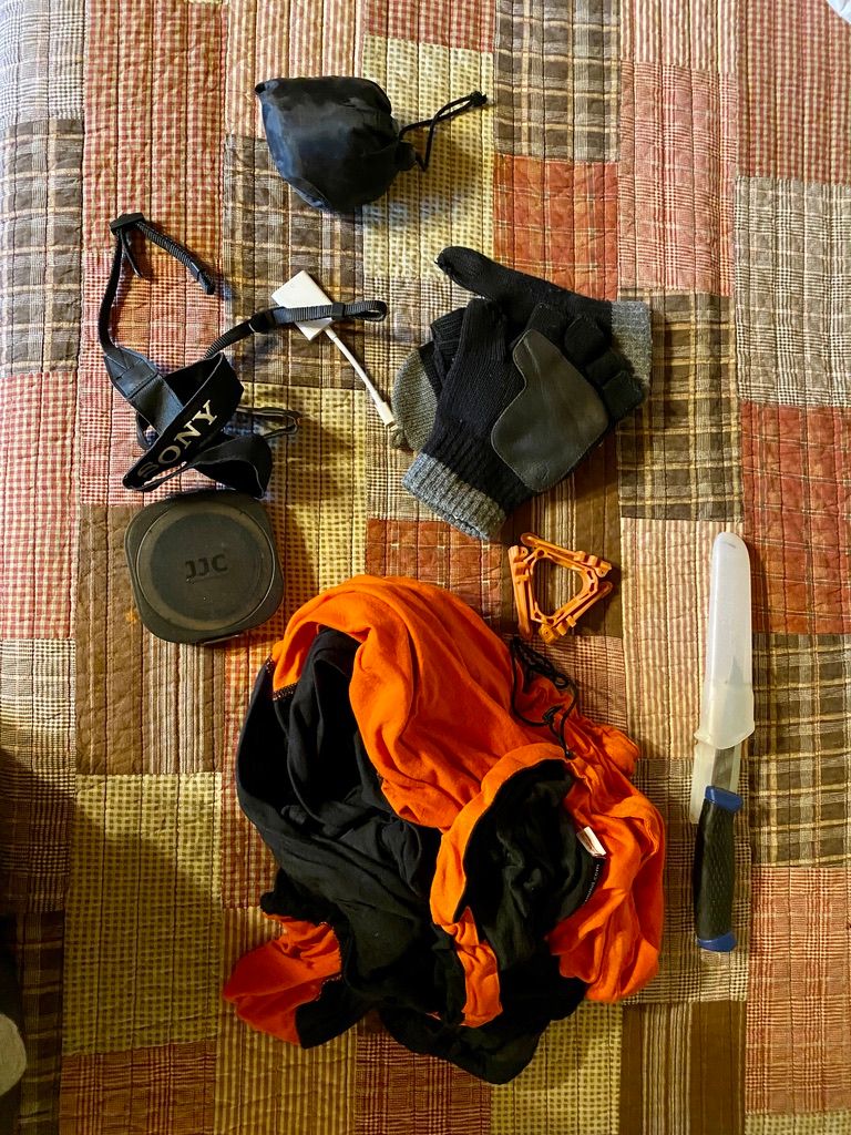
Idyllwild is a popular stop for PCT hikers. A small mountain town nestled on the western side of the San Jacintos, it caters to outdoor enthusiasts. I was happy to replace a clogged water filter at Nomad Ventures and stopped by Village Hardware for a new charging cable and more durable gloves.
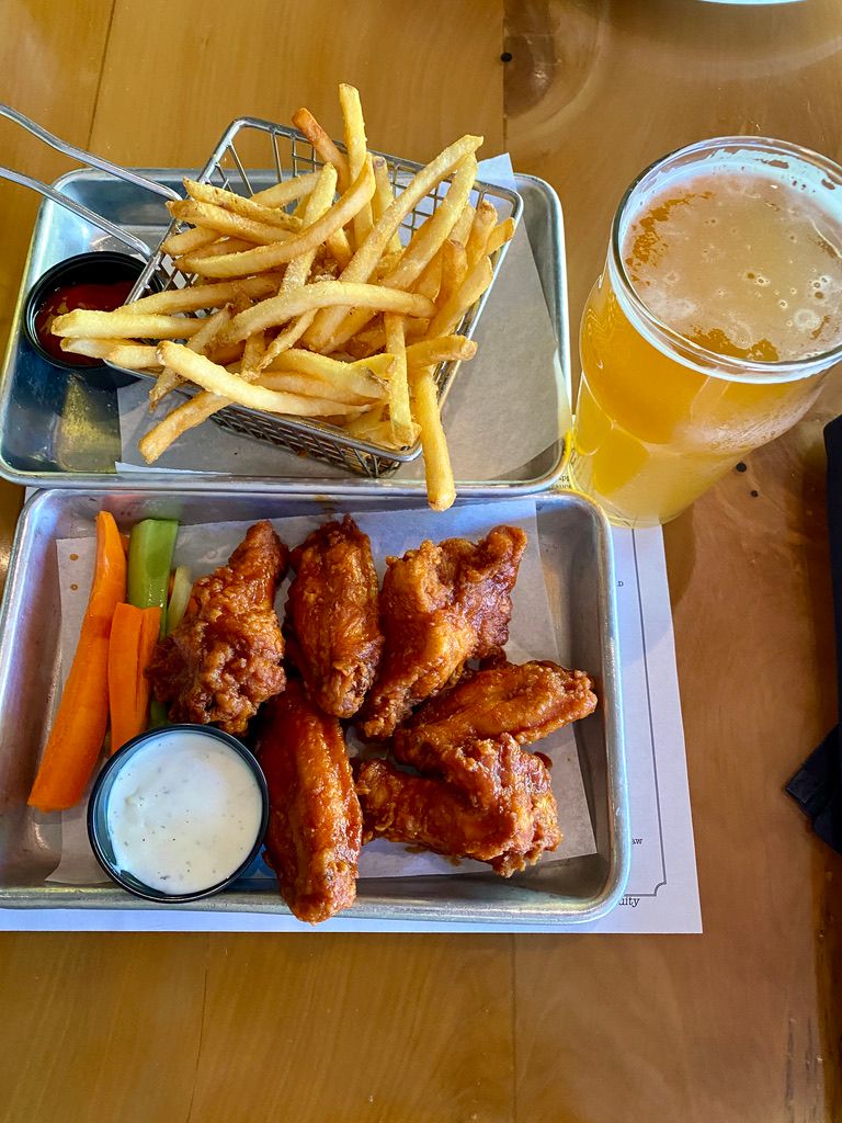
Only a two hour drive from the heart of downtown Los Angeles, it’s also a popular getaway destination for residents of the city. Expect crowds on the weekend. With all of these short term visitors, you can expect the trappings of a tourist town as well. Idyllwild is rounded out with multiple ice cream shops, full-size grocery stores, and a wide variety of restaurants. Once done with my chores, Idyllwild Brewpub was the perfect place to park my butt in a chair for an hour and gaze upon the conifer forests from the outdoor patio while eating salty french fries washed down with some tasty local beers.
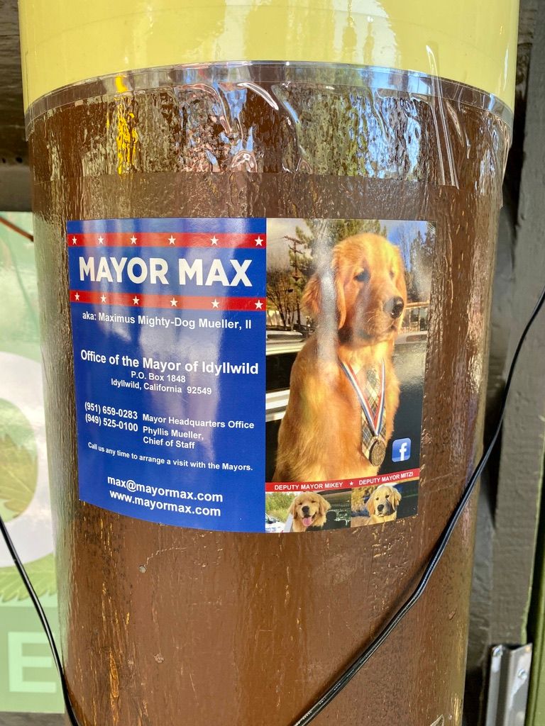
With everything downtown in walking distance and a ton of options, Idyllwild would be a great place to take a zero day. Many hikers look forward to a chance to meet Mayor Max, a golden retriever with a fat neck tie you can’t help but pet over and over again.
Making it to town in the early afternoon, I decided to get back on trail the next morning. The Idyllwild Inn provides a convenient morning shuttle back to Devil’s Slide Trailhead, and I was back to walking before the coolness of the morning was baked off by a bright sun. It was a slow start given the fully resupplied pack and 1500 feet of elevation to be regained. After just a few miles though, the trail gives way to a huge descent down the north face of San Jacinto.

📉 The Big Drop
The unending walk out of the mountains down to Interstate 10 defined this section of the hike for me, if you couldn’t tell from the introduction. Gazing from the mountain tops you have a clear line of sight all the way down to the windmill-riddled valley below. You hike for many hours, without the windmills ever appearing closer. But as you keep going, details begin to emerge. The three blades of each windmill are visible. Power lines that crawl over the lower hills emerge. Look back and suddenly the mountain you were once on top of is a sight in and of itself. The shift of enormity, from the valley below to the towering rocks behind had me repeating over and over to myself, I’m hiking this thing.
I took a moment to sit down at the dining table set up in the hiker oasis under Interstate 10, just trying to absorb the PCT’s vastness of scale. I’m doing this, and there is SO much more to go.

Learn Things
🌵 Ecological Zones
North America has seven ecological zones:
- Tropical
- Lower Sonoran
- Upper Sonoran
- Transition
- Canadian
- Hudsonian
- Arctic-alpine
Each zone supports different varieties of plants and animals, depending on different climate factors. Generally, the zones correspond to lines of latitude, changing as you proceed north or south, but they also change with elevation. As a rule of thumb, every 1000 feet of elevation brings with it a drop in temperature between 3 and 5 degrees, which means in your 4000 feet of elevation gain from Paradise Valley Cafe to Idyllwild’s Saddle Junction is the ecological equivalent of hiking about 600 north. It’s like you get to experience Oregon from Southern California.
The PCT passes through six of the seven ecological zones, and section B marks the first time you will enter the Canadian Zone, which is the lowest of the three boreal, or northern, ecological zones.
🌲 The Canadian Zone and It’s Conifers
The red fir and lodgepole pine trees of the Canadian Zone are well adapted to the climate factors prevalent there. The air is almost always dry and the temperatures range from extreme summer heat to bitter winter cold. This leads to a short growing season in spring when the thermometer find a middle ground and moisture lingers from all the snowmelt.
The most noticeable trait of these conifers are their waxy green needles. The coating itself acts as a sealing agent to prevent moisture loss, while the resin inside helps to insulate the plant from the extreme temperatures. Beyond that, the conical shape of the trees help them to shed heavy snow in the winter and allow light to penetrate to the lowest limbs. More uses beyond stringing up tinsel and Christmas ornaments! When the lower limbs become unproductive members of society, using more nutrients than they produce via photosynthesis, mature conifers will sometimes simply jettison them to the ground below. This is why you may notice some of the lowest limbs of older conifers present over 60 feet from the forest floor.

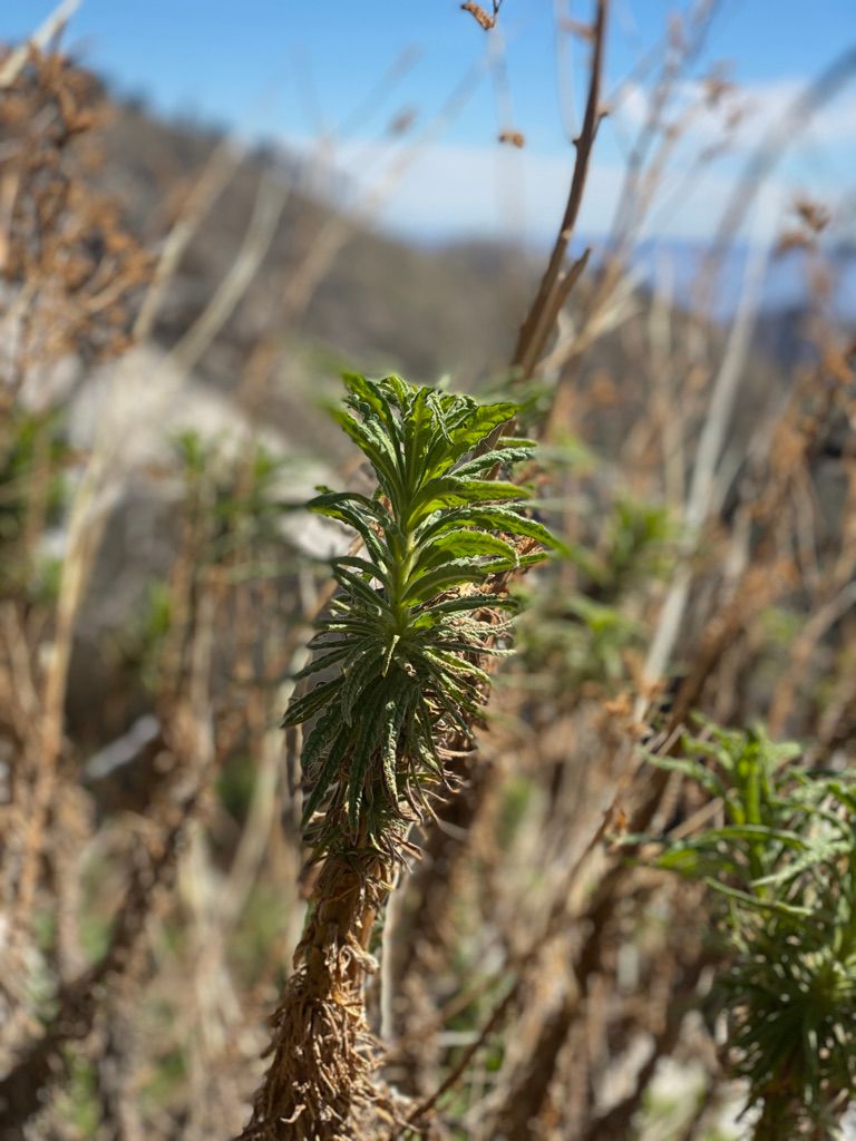
👹 Snow Plant
The aliens have landed, and they planted these peculiar nontraditionalists. For a forest floor plant like a snow plant, the primary challenge to biological success is lack of sunlight. Most combat the difficulty by being as plantlike as a plant can get. They wield intense dark green leaves packed to the seams with the chloroplasts required for photosynthesis, becoming food factories from the tiniest drops of sunshine. Their leaves are often smooth and broad in an effort to maximize direct light absorption.
The snow plant is the rebellious kid in high school who eschews plant norms and dyes her hair bright red. She battles the low light problem by doing away with photosynthesis altogether in favor of a mutual relationship with the surrounding fungi. In a process called mycoheterotrophy, the snow plant provides fixed carbon to the fungi and receives mineral nutrients, water, and protection from pathogens in return. Pretty danged neat if you ask me.

🐶 Mayor Max of Idyllwild
If you take some time off trail in Idyllwild, you’ll want a picture with its goodest resident, who also happens to be the mayor. As an unincorporated town, Idyllwild has no human mayor, but the clever residents there figured that doesn’t rule out its pups. Idyllwild Animal Rescue Friends (ARF) is a nonprofit organization that sponsored the town’s first mayoral election where any local was permitted to nominate his or her dog or cat. Citizens cast votes for $1 a piece, raising a total of $31,000 and putting a golden retriever in the prestigious seat of first-ever-mayor on July 1 2012. Max won a full two-thirds of the votes, beating out 14 other cute dogs and 2 adorable cats.
Installed for only a one year term, Max’s popularity moved his constituents to extend him year on year in the seat of mayor until his unfortunate passing in April 2013. Thankfully, Max I laid out a smart succession plan and Max II was installed into office in July of that year. In March 2014, ARF polled the residents of Idyllwild regarding their interest to hold another election for mayor but Max II was doing such a good job that everyone elected to maintain his position for perpetuity.